TRENDEFRARAtlas of the Sultans · Ottoman monuments
Bridge of Arta
Monument · Bridge, Arta, 15th century
- Type
- Bridge
- Location
- Greece
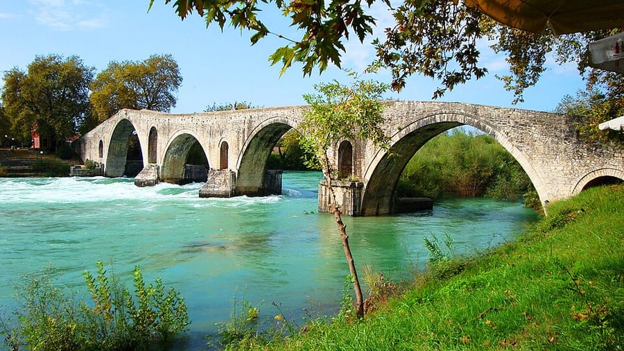

The bridge of Faik Pasha
The bridge spans the Arachthos river at Arta in western Greece, a town known as Narda in the Ottoman period. It was built shortly after the conquest of the area, most probably by Faik Pasha, one of the viziers of Sultan Mehmed II (the Conqueror). It was presumably part of the complex (külliye) that Faik Pasha founded in the nearby village of Imaret, comprising a mosque, an inn, a bath, a soup kitchen, a madrasa and his tomb; his endowment deed is dated 1492–93. Evliya Çelebi calls it the “thirteen-arched bridge of Faik Pasha” and notes that two carts could cross it side by side.
According to the measurements given by A. K. Orlandos, the bridge is 142 m long and 3.75 m wide, with four large and three small openings. Its arches are round, and the largest is not in the centre but towards one end, so the bridge rises gently and then drops steeply to the bank. Orlandos argued that the bridge was originally Roman. Even if remains of a Roman bridge lie in its foundations, the structure standing today is one of the monuments left by the Ottoman period in the Balkans. Arta was ceded to Greece in 1881.
The bridge in the sources
Listing the charitable works of the viziers of Mehmed the Conqueror's reign, Aşıkpaşazade notes that Faik Pasha intended to build pious foundations at Narda. An addendum was attached in 1501–1502 to the pasha's endowment deed of 1492–93. Evliya Çelebi writes that the middle arch of the bridge was very high and wide, reaching 50 cubits in height, that the bridge was 800 paces long from one end to the other and that four of its arches were each a hundred paces wide; he adds that the Narda river flowing beneath it empties into the Gulf of Preveza.
Major Halil Ibrahim Efendi, who prepared a map of Narda and its surroundings during the Turkish-Greek war of 1897–1898, marked on it the town, the bridge and the village of Imaret. According to his note, the bridge provided the main link between the southern part of the province of Yanya and western Greece; at the place called Köprübaşı stood Faik Pasha's mosque and soup kitchen, and the grave of the pasha, who died in 1499–1500, lay beside the mosque.
Dimensions and legends
The openings that Orlandos calls “small arches” are those above the cutwaters of the piers and the flood openings. Although Evliya Çelebi wrote that the middle arch was the high one, today the largest arch lies near one end; the author of the entry, Semavi Eyice, notes that the question could be clarified by investigating whether the short side of the bridge was once longer.
The story related by Orlandos, that the bridge was built in the early 17th century by a certain Gianni Thiakogianni with gold found by chance in olive-oil jars taken from Algerian corsairs, is described as a later invention. The bridge holds an important place in Balkan folklore. Arta was among the territories ceded to Greece under Article 24 of the 1878 Treaty of Berlin and was formally evacuated and handed over on 6 July 1881.
Source: TDV Encyclopedia of Islam (TDV İslâm Ansiklopedisi), “ARTA KÖPRÜSÜ” (Semavi Eyice)
Related sultans
Cite as: Atlas of the Sultans, “Bridge of Arta · Ottoman monuments”, https://padisahlaratlasi.com/en/monuments/bridge-of-arta/ (last updated 21 November 2026). Corrections · Image credits