All toursTRENDEFRAR
Ottoman lands

Map tour · 1487–1554 · 9 stops · 8 min read

Piri Reis and Ottoman Seafaring

From Gallipoli to Hormuz: the life of a seaman and mapmaker from the Mediterranean to the Indian Ocean

Scroll to continue ↓

1470 – 1487

A seafaring family from Gallipoli
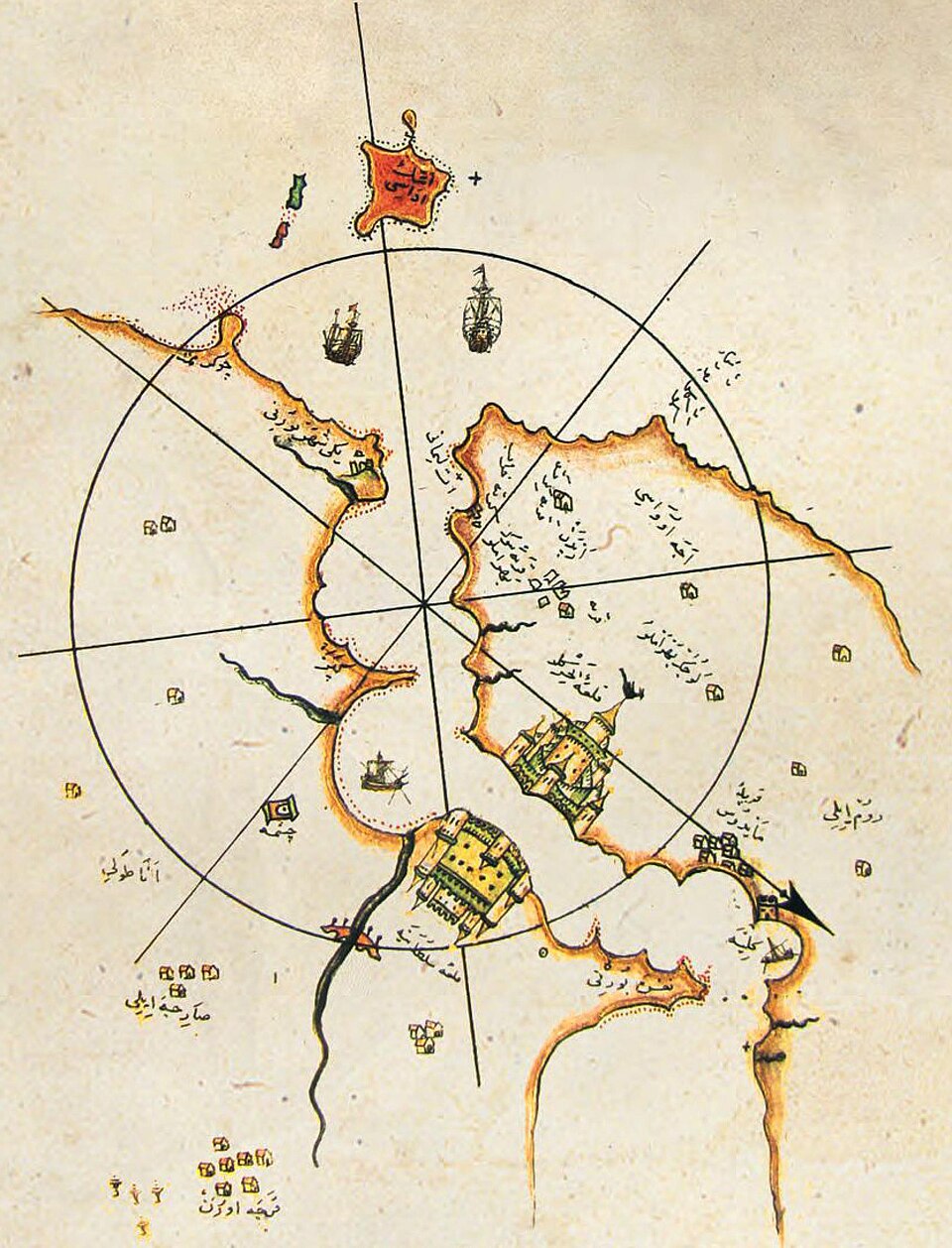
Map of Gallipoli (Gelibolu) from the Kitab-ı Bahriye.
Map of Gallipoli (Gelibolu) from the Kitab-ı Bahriye. · Image: Wikimedia Commons (public domain)

Piri Muhyiddin b. Hacı Mehmed was born in Gallipoli (Gelibolu); judging by the years he spent with his uncle Kemal Reis, it has been suggested that he was born around 1470. What we know of his life rests mostly on his own statements in his work, the Kitab-ı Bahriye. His uncle Kemal Reis was also a native of Gallipoli, though some sources say he came from Karaburun. In 1470 Kemal Reis had taken part as a marine (azap) in Grand Vizier Mahmud Pasha's campaign against Euboea (Eğriboz), and then, with a light galley he fitted out, began raiding Venetian ships, fortresses and coasts. In 1487, answering the appeals of the Andalusian Muslims massacred in Spain, Bayezid II charged Kemal Reis and his seamen, with a fleet and munitions he had prepared, to strike south-western Spain. On these raids Kemal Reis defeated a Spanish fleet and plundered Málaga; in North Africa he made Djerba, Béjaïa (Bicaye) and Annaba (Bune) his bases.
1487 – 1495/96

With his uncle in the western Med

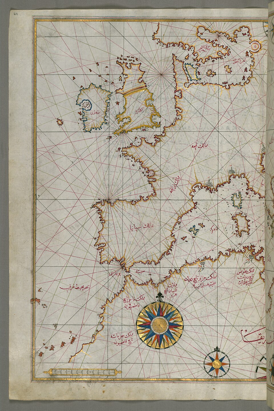
Map of western Europe and North Africa from a later copy of the Kitab-ı Bahriye.
Map of western Europe and North Africa from a later copy of the Kitab-ı Bahriye. · Image: Wikimedia Commons (public domain)

According to his own account in the Kitab-ı Bahriye, Piri sailed as a corsair with Kemal Reis across the whole Mediterranean, above all against Venetian fortresses and coasts. Near Izledare, the Hyères Islands south-east of Toulon, they seized three merchant ships and sold them in Tunis; near Majorca they took a watchtower. They captured and plundered the island of Pianosa near Corsica and took seven ships off Valencia; at Pantelleria, however, a change of wind forced them back empty-handed. In North Africa they wintered twice, at Annaba (Bune) and Sfax; Piri writes that he met the Sultan of Tunis, Mawlay Muhammad, and that they stayed at a Sufi lodge in Béjaïa. In 1492, after striking the coasts of France, the Balearic Islands and Malta, Kemal Reis came to Gallipoli with his booty and was granted a salary. The raids in which Piri took part continued until 1495–96.

1495 – 1510

In state service at his uncle's side

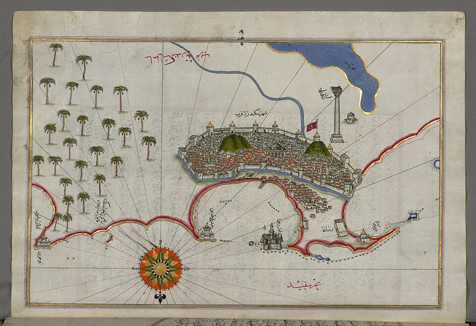
Map of Alexandria from a later copy of the Kitab-ı Bahriye.
Map of Alexandria from a later copy of the Kitab-ı Bahriye. · Image: Wikimedia Commons (public domain)

In 1495 Bayezid II summoned Kemal Reis to Istanbul to build up the fleet against Venice; Piri was probably with him. He took part when his uncle carried the revenues of the Anatolian endowments for Mecca and Medina by sea to Alexandria, and in the clashes with the Knights of Rhodes on the way back. He served under him as a galley captain at the siege of Lepanto in 1499, at the conquest of Modon and Coron in 1500 and of Navarino in 1501; Lepanto had surrendered on 28 August 1499. After the peace of 1502 he was again with his uncle in the squadron sent to protect trade in the Aegean and in the embassy to the Mamluk state. He joined the 1504 expedition to Rhodes for the Muslim captives there and the 1505 voyage to Tripoli, and sailed with the fleet carrying troops, munitions and guns to the Mamluks against the Portuguese. Kemal Reis died in October 1510 when his ship sank in a storm.

1513

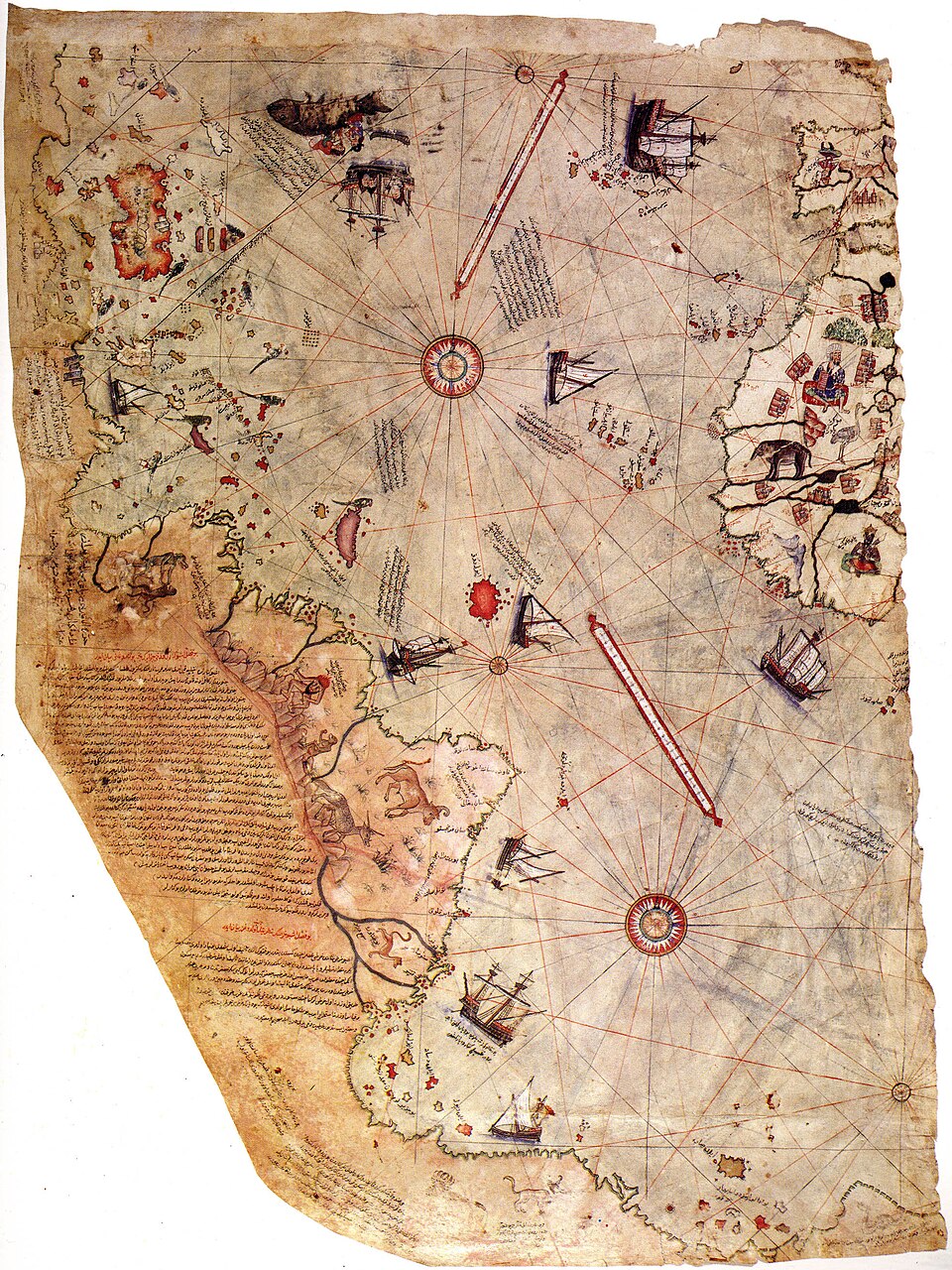
A world map drawn at Gallipoli

The surviving fragment of Piri Reis's world map of 1513.
The surviving fragment of Piri Reis's world map of 1513. · Image: Wikimedia Commons (public domain)

With the death of Kemal Reis a new period began in Piri Reis's life. In 1513 (919 AH) he drew a world map at Gallipoli. The surviving fragment shows the coasts of Spain, Portugal and West Africa and the eastern coasts of the American continent. Its sources were old maps that had reached him from East and West, together with a map by Christopher Columbus. The map contains clues showing that the new discoveries made up to that time had been followed closely; Piri Reis evidently kept a careful eye on the Portuguese and Spanish voyages in the Indian and Atlantic oceans. In the Kitab-ı Bahriye he also writes that he was the first to obtain information about the newly made maps of the Indian and Chinese seas. This first world map is kept today in the Topkapı Palace Museum Library.

1517

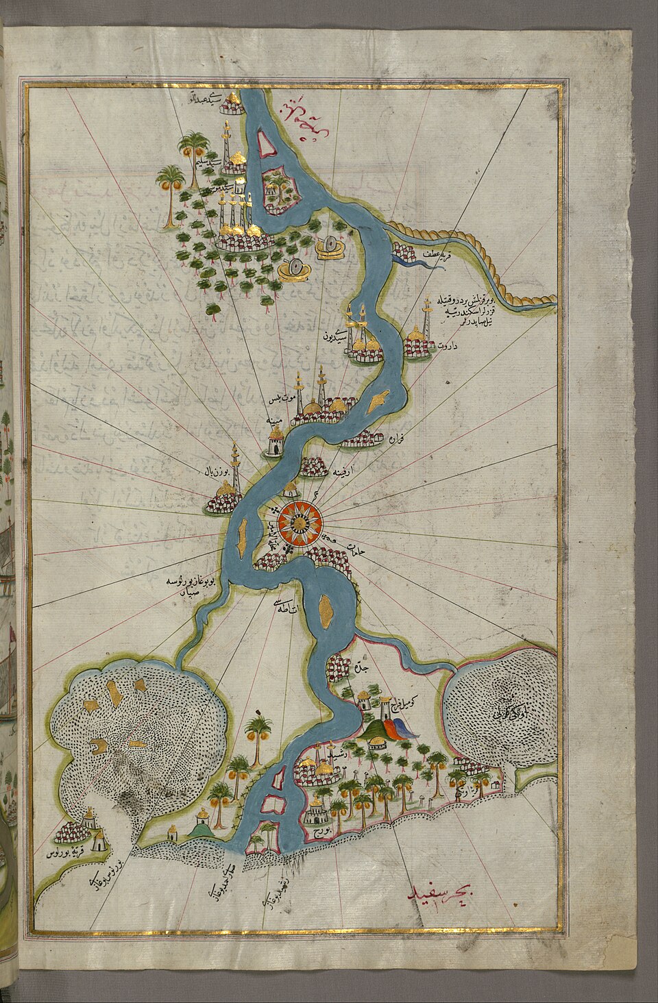
Egypt: the map presented to Selim

Map of the Nile from its mouth southward, from a later copy of the Kitab-ı Bahriye.
Map of the Nile from its mouth southward, from a later copy of the Kitab-ı Bahriye. · Image: Wikimedia Commons (public domain)

During Sultan Selim I's Egyptian campaign Piri Reis served as a ship's captain in the fleet commanded by Grand Admiral Cafer Bey. He reached Cairo by way of the Nile and there presented his world map of 1513 to the sultan (923/1517). In the Kitab-ı Bahriye he states that he also presented the new maps of the Indian and Chinese seas to Selim. In the Kitab-ı Bahriye he would later write, the description of the Mediterranean basin passes from North Africa to Egypt and the Nile, and from there to the Syrian coast, Cyprus and Karaman. The maps of the work also include drawings of important buildings; shallows, beaches, safe harbours, reefs, the seasons and courses suitable for sailing, water sources and settlements are carefully marked, just as on portolan charts.

1521 – 1522

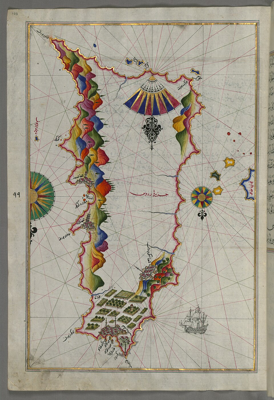
Belgrade, Rhodes, first Kitab-ı Bahriye

Map of the island of Rhodes from a later copy of the Kitab-ı Bahriye.
Map of the island of Rhodes from a later copy of the Kitab-ı Bahriye. · Image: Wikimedia Commons (public domain)

During Sultan Suleiman the Magnificent's Belgrade campaign of 1521 Piri Reis served in the Danube flotilla, and the following year he took part in the Rhodes campaign as well. In 1521 (927 AH) he also completed the first version of the Kitab-ı Bahriye at Gallipoli. He says he wrote it to make use of the material he had gathered on the voyages with Kemal Reis and his companions and to leave it behind as a “gift”. The book was prepared for presentation to Süleyman, who had come to the throne in 1520, but it could not be presented to him. Written entirely in prose, with the descriptions set down first and the outlines of the places drawn afterwards, this version begins its descriptions at Bozcaada; copies with 120 to 134 maps survive. A complete portolan atlas of the Aegean and Mediterranean coasts, the Kitab-ı Bahriye can be regarded as the first Ottoman portolan atlas.

1524 – 1537

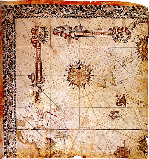
The second version for Süleyman

The surviving fragment of Piri Reis's second world map of 1528.
The surviving fragment of Piri Reis's second world map of 1528. · Image: Wikimedia Commons (public domain)

In 1524 Piri Reis served as pilot in the fleet of Grand Vizier Ibrahim Pasha, who was sailing to Egypt to put down the revolt of Ahmed Pasha “the Traitor”; on board, the grand vizier examined the draft of the Kitab-ı Bahriye. When bad weather made Ibrahim Pasha continue overland after Rhodes, Piri returned to Gallipoli to make a fair copy of his book. The second version, whose verse sections were written by Seyyid Muradi, was presented to Süleyman through Ibrahim Pasha in 1526 (932 AH); the number of maps, at most 134 in the first version, rises to 223 in the second. In 1528 Piri Reis also presented to the sultan his second world map, showing the northern Atlantic and the coasts of North and Central America. Because he is called “Piri Kethüda” at this time, he is thought to have held a post at the Gallipoli arsenal. He later joined the fleet of Hayreddin Barbarossa Pasha; on 22 August 1537, in the fleet gathered at Vlorë (Avlonya) for the siege of Corfu, he was given a robe of honour.

1547 – 1549

Captain of the Indian fleet: Aden

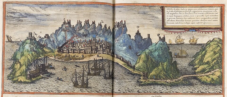
View of Aden from Braun and Hogenberg's work of 1572.
View of Aden from Braun and Hogenberg's work of 1572. · Image: Wikimedia Commons (public domain)

In 1547 Piri Reis was appointed captain of the Indian fleet in place of Ferhad Pasha. His first task was to take back Aden, the only Ottoman base in the Indian Ocean, from its local ruler Ali b. Süleyman. On 29 October 1547 he set out from Suez with a fleet of sixty ships and first landed at the port of Mocha. Reinforced by Ferhad Pasha, beylerbey of Yemen, the fleet reached the Aden area in November 1548; three Portuguese ships were captured and the 120 sailors aboard taken prisoner. When the former sanjak bey of Aden, Kasım Bey, moved by land and Piri Reis by sea, the Portuguese ships that had come to help turned back on sighting the Ottoman fleet. On 20 December 1548 Piri Reis arrived before Aden and landed troops and guns; after a general assault Aden was reconquered on 12 February 1549. He was rewarded with a raise of 100,000 akçe.

1552 – 1553

Hormuz and death in Cairo

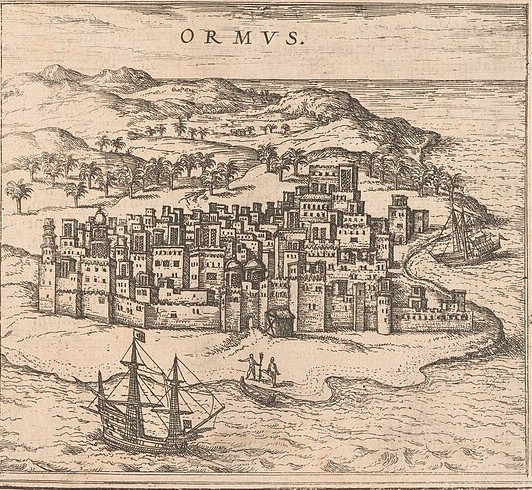
View of Hormuz from Braun and Hogenberg's work of 1572 (detail of the plate).
View of Hormuz from Braun and Hogenberg's work of 1572 (detail of the plate). · Image: Wikimedia Commons (CC0)

Setting out from Suez in May 1552 with a fleet of thirty ships, Piri Reis passed the Bab el-Mandeb into the Indian Ocean and in the Sea of Oman took Muscat after a week-long siege. He then besieged Portuguese-held Hormuz with twenty-eight ships and 850 soldiers; almost the whole island was taken, but the inner citadel held out. Fearing a surprise attack by a superior Portuguese fleet, he lifted the siege and headed for Basra. Leaving his fleet at Basra, he sailed with three galleys to Suez and went on overland to Cairo. Accusations that he had lifted the siege in return for bribes had reached Egypt; the TDV article notes that the arrival of a Portuguese fleet off Hormuz soon afterwards shows these charges were unfounded. Piri Reis was probably put to death in the Council of Egypt at the end of 1553; his property was confiscated and sent to Istanbul.

End of the tour

The texts are based on the TDV Encyclopedia of Islam articles below. Borders are drawn from the atlas's regional data and are approximate; see the Method page.

Sources

More tours